Late January. Every post I could find was full of people that have only biked out to Knik Glacier in March, and yet I wasn't sure why it's not possible to do in the middle of winter. From Hunter Creek, it's only about 10 miles one-way, and thus if you start just as the sky is getting light, you should be able to get back before total dark.
We unsucessfully attempted to bike out to Knik Glacier via Jim Creek Trailhead in early January. The original plan was to go in from Hunter Creek, but my friend had noted that they had attempted to bike in the day before, and the Knik River was still open water. So we started on the Jim Creek side. The temperature hit a high of -6F, and we made it 16 miles in, and were only 2 miles away from the glacier, but we were too cold even to have the energy to eat, and it was 2:30pm, so it was time to head back.
We parked in a large pullout just a hundred feet beyond the Hunter Creek bridge. The ice climbing groups use this pullout as well, to hike a few miles up Hunter Creek to a waterfall. We put our skis on right as the sun was hitting the tips of the peaks across the valley. It was pretty straightforward finding the way out of the valley.
Once in the Knik River valley, the river channel itself was very frozen, but we've had an abnormally cold winter, and I'm not sure how this compares to other years. I know from aerial imagery if you follow the Knik River up to where it is pinched against the cliff faces, and you're forced to cross, the river is iced over in that location well into April. But when it first begins to ice over is a question I still have, and something I'll have to explore in future years.
We crossed Knik River near a large open area, and that river was flowing deep and fast! I was surprised how fast it was moving. I brought rope just in case, but there were snowmachines that had crossed in the same location a few days earlier so I was letting that give me a (false?) sense of security that everything would hold.
It's a straight-shot of skiing up to the glacier from there, though as I learned from my friend who went out on his fat bike a week later, this area changes quickly! There was absolutely ZERO snow left on the ground, due to a large wind event. There was lots of ice and overflow, and skis were out of the question. Only biking and walking would be options.
We spent a solid 1.5 hours exploring the glacier, and made it back to the cars 9.5 hours after we began, right at the end of nautical twilight, and about the point where we would need a headlight to go further.
Heading down Hunter Creek
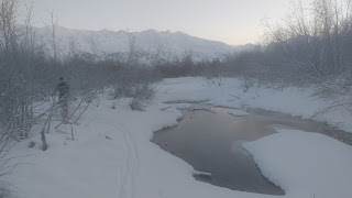
A stream feeding into Hunter Creek
There were a few areas of open water where we had to find a way around
It's a snowmachine highway! Someone definitely trims the vegetation here; though it's in such a boggy area I'm sure it's only for snowmachine use, and not ATV's in the summer. I have heard that someone in the past used to groom this area for skiing?
An arm of Knik River we crossed
This is the main channel across the Knik River. It is about 0.4 miles across, and there was some FAST moving water in an open area nearby. However, snowmachine tracks gave us a little more confidence that the ice would hold.
Looking across the valley at the Jim Creek side
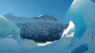
Looking back at the glacier, and Gorgemeister (center right)
There's a small hill you must ski up and drop down to get to the lake
The descent onto the lake
Looking out toward Lake George
Heading back, with Pioneer Peak in the distance


This comment has been removed by a blog administrator.
ReplyDelete